This article was written by Andrew Miles Consultation Specialist, Transport for London(TFL).
TFL are corporate members of the Institute. To find out more about membership, click here.
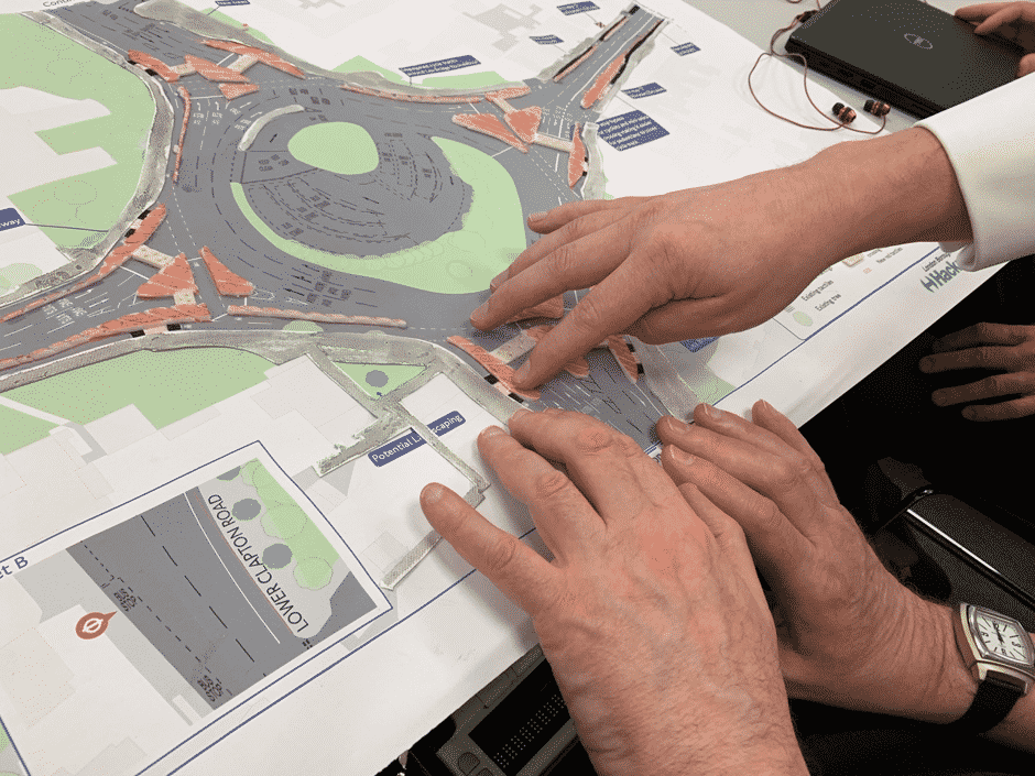
Transport for London (TfL) recently explored a new way to present proposals for improvements to London’s streets. For the first time, and for a recent meeting with the National Federation of the Blind UK, TfL produced a number of tactile maps. These helped several blind and partially sighted attendees to understand TfL’s proposals by touch and feel.
![]()
We produced the maps by selecting key features of the proposals which they felt would be of greatest interest to blind or partially-sighted people. TfL took a ‘less is more’ approach in this, to avoid the maps becoming cluttered. The key features were picked out with a variety of materials which had a distinctive texture and feel, and which were used consistently across the maps to describe key features. The base maps themselves were the same as TfL had provided to every potential respondent to the consultation.
![]()
We learnt a number of useful lessons, including how we might improve the maps in future and make them more robust. For the most part, the session reinforced the benefits we get as consultees in producing fully-accessible consultation materials. It also showed how rewarding it could be to take a flexible approach to engaging with hard-to-reach audiences, for example by taking the extra time to explain the proposals and to meet in a quiet, distraction-free venue.
NFBUK gave us detailed and very useful feedback, and we were very grateful indeed for their time and insights. Their feedback is helping us to refine and improve our proposals, to the benefit of everyone. We were very pleased with the experience and the outcomes of our discussions.